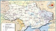
Big collection of historical maps covering the Ukrainian history from its beginning to our days – 1470-2014.
- Ukrainian Lands in the 15th Century
- Principality of Kiev, 1470
- Liberation War of the Ukrainian People, 1648-1654
- Ukraine in the 17th-18th Centuries
- Southern Ukraine in the Second Half of the 18th Century
- Southern Ukraine in the 19th and 20th Centuries
- Linguistic Map of Ukraine (Southern Russia), 1871
- Economic Map of the Ukrainian Lands at the Beginning of the 20th Century
- Ethnographic Map of Ukraine, cca. 1900
- Ukraine at the Beginning of the 20th Century
- Ukraine During the Russian Revolution, 1905-1907
- Ukraine, 1907-1914
- Ukrainian Lands, 1914-1919
- Ukrainian Territories, 1914-1920
- The Ukrainian Lands in 1917-1921
- South Russian Republics, 1917-1918
- Ukrainian Peoples Republic
- Ukrainian Peoples Republic, 1917-1918
- Ukraine, March-November 1918: German Occupation & Hetmanate
- West Ukrainian Peoples Republic
- West Ukrainian Peoples Republic, 1918
- Donetsk-Krivoy Rog Soviet Republic, 1918
- West Ukrainian Peoples Republic, 1919
- La République Ukrainienne (Conférence de Paix de Paris, 1919)
- Great Ukraine, 1919 (A Nationalist View)
- Ukraine, May-November 1919
- Economic Map of the Ukrainian SSR in 1921-1928
- Ukrainian SSR in 1939
- Ukrainian SSR at the Beginning of 1940
- Ukrainian SSR in January 1940
- Ukrainian SSR – Economic Map
- Ukraine during the De-Stalinization (1953-1964)
- Ukrainian SSR in 1970
- Ukraine 1991-2014
- Ukraine 1991-2004: Election Results
- Ukraine 2004: Election Results
- Ukraine 2010: Presidential Election Results
- Ethno-linguistic Map of Ukraine
- Linguistic Map of Ukraine (2003)
- Map of the Ukrainian Dialects
- Russians in Ukraine (2001 Census)
- The Ukrainian Crisis and the Cyberspace (Kevin Limonier)
- Republic of Crimea 2014 (Annexed by Russia)
